Alappuzha
Alappuzha district, is one of the 14 districts in the Indian state of Kerala. It was formed as Alleppey district on 17 August 1957, the name of the district being changed to Alappuzha in 1990, and is the smallest district of Kerala. Alleppey town, the district headquarters, was renamed Alappuzha in 2012, even though the anglicised name is still commonly used to describe the town as well as the district.
See More
Ernakulam
Ernakulam, is one of the 14 districts in the Indian state of Kerala, that takes its name from the eponymous city division in Kochi. It is situated in the central part of the state, spans an area of about 3,000 square kilometres, and is home to over 9% of Kerala's population. The district includes Kochi, also known as the commercial capital of Kerala, which is famous for its ancient Churches.
See More
Idukki
Idukki, is one of the 14 districts in the Indian state of Kerala. Idukki district lies amid the Cardamom Hills of Western Ghats in Kerala. Idukki district contains two municipal towns. The district currently includes five taluks in it. The district was constituted on 26 January 1972, by taking Peerumade, Udumbanchola, Devikulam taluks of the former High Range division from Kottayam district and the Thodupuzha taluk from Ernakulam district.
See More
Kannur
Kannur, is one of the 14 districts along the west coast in the state of Kerala, India. The city of Kannur is the district headquarters and gives the district its name. Kannur district is bounded by Kasaragod District to the north, Kozhikode district to the south, Mahé district to the southwest and Wayanad District to the southeast. To the east, the district is bounded by the Western Ghats, which forms the border with the state of Karnataka (Kodagu district). The Arabian Sea lies to the west.
See More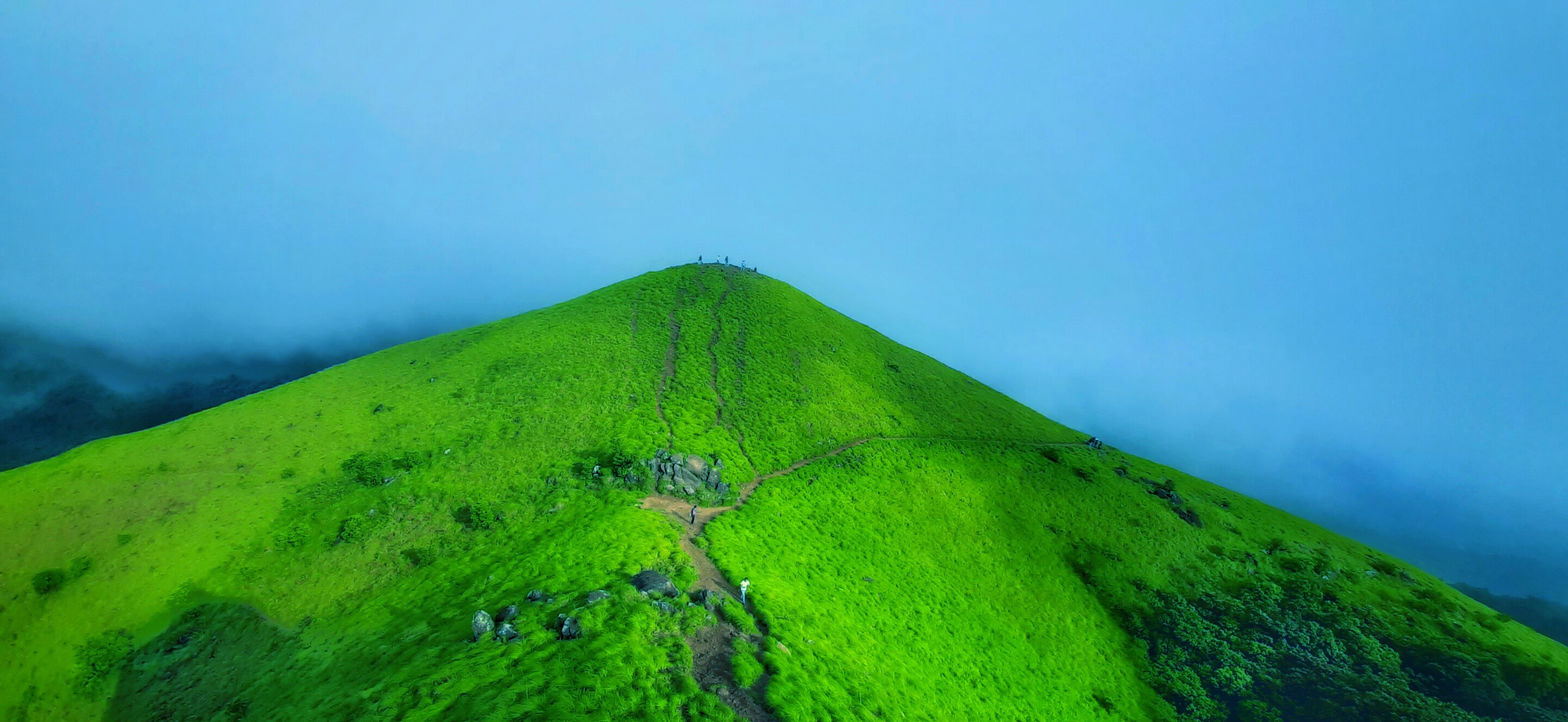
Kasaragod
Kasaragod is one of the 14 districts in the southern Indian state of Kerala. Its northern border Thalappady is located just 10 km south to Ullal, which is the southernmost portion of the major port city Mangalore, on the southwestern Malabar coast of India. Kasaragod is the northernmost district of Kerala and is also known as Saptha Bhasha Sangama Bhoomi as seven languages namely, Malayalam, Tulu, Kannada, Marathi, Konkani, Beary, and Urdu are spoken, unlike the other districts of Kerala.
See More
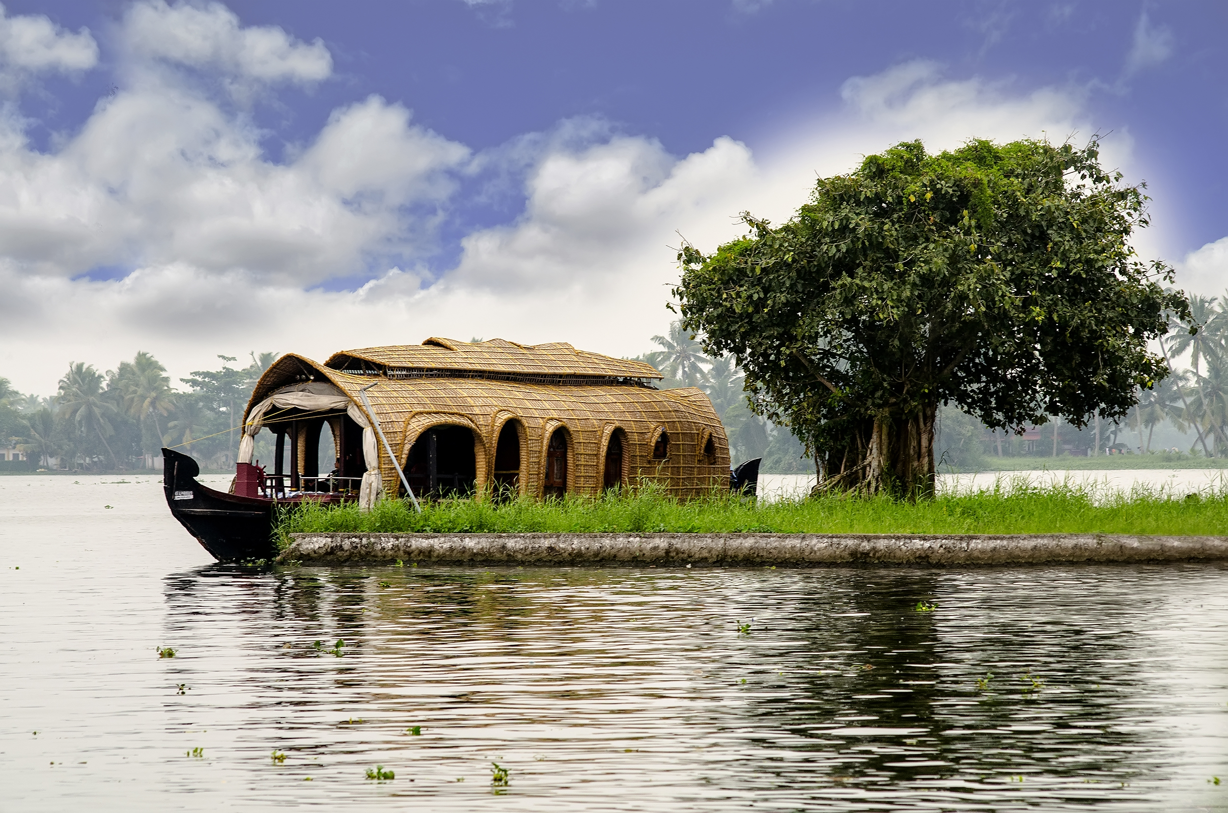
Kollam
Kollam district (Malayalam: [kolːɐm] (listen)), (formerly Quilon district) is one of 14 districts of the state of Kerala, India. The district has a cross-section of Kerala's natural attributes; it is endowed with a long coastline, a major Laccadive Sea seaport and an inland lake (Ashtamudi Lake). The district has many water bodies. Kallada River is one among them, and the east side land of river is East Kallada and the west side land is West Kallada.
See More
Kottayam
Kottayam is one of 14 districts in the Indian state of Kerala. Kottayam district comprises six municipal towns: Kottayam, Changanassery, Pala, Erattupetta, Ettumanoor, and Vaikom. It is the only district in Kerala that neither borders the Arabian Sea nor any other states. The district is bordered by hills in the east, and the Vembanad Lake and paddy fields of Kuttanad on the west. The area's geographic features include paddy fields, highlands, and hills.
See More
Kozhikode
Kozhikode district, or Calicut district, is one of the 14 districts in the Indian state of Kerala, along its Southwestern Malabar Coast. The city of Kozhikode, also known as Calicut. The district is 67.15% urbanised. The Kozhikode Municipal Corporation has a corporation limit population of 609,224 and a metropolitan population of more than 2 million, making Kozhikode metropolitan area the second-largest in Kerala and the 19th largest in India. Kozhikode is classified as a Tier 2 city by the Government of India.
See More
Malappuram
Malappuram is one of the 14 districts in the Indian state of Kerala, with a coastline of 70 km. It is the most populous district of Kerala, which is home to around 13% of the total population of the state. The district was formed on 16 June 1969, spanning an area of about 3,554 km2. It is the third-largest district of Kerala by area, as well as the largest district in the state, bounded by Western Ghats and Arabian Sea to either side.
See More
Palakkad
Palakkad is one of the 14 districts in the Indian state of Kerala. It was carved out from the southeastern region of the former Malabar District on 1 January 1957. It is located at the centre of Kerala. The city of Palakkad is the district headquarters. Palakkad is bordered on the northwest by the Malappuram district, on the northeast by Nilgiris district, and on the east by Coimbatore district of Tamil Nadu. The district is nicknamed "The granary of Kerala".
See More
Pathanamthitta
Pathanamthitta District is one of the 14 districts in the Indian state of Kerala. The district headquarters is in the town of Pathanamthitta. Municipalities in Pathanamthitta: Pathanamthitta and Thiruvalla. According to the 2011 Census of India, the population was 1,197,412, after Wayanad and Idukki.Pathanamthitta has been declared the first polio-free district in India. The district is 10.03% urbanised.
See More
Thiruvananthapuram
Thiruvananthapuram District is the southernmost district in the Indian state of Kerala. The district was created in 1949, which is also Kerala's administrative centre. The present district was created in 1956 by separating the four southernmost Taluks of the erstwhile district to form Kanyakumari district. The city of Thiruvananthapuram is also known as the Information technology capital of the State.
See More
Thrissur
Thrissur (formerly Trichur) is one of the 14 districts in the Indian state of Kerala. Thrissur district is home to over 9% of Kerala's population. Thrissur district is bordered by the districts of Palakkad and Malappuram to the north, and the district of Ernakulam to the south and Coimbatore to the east. The Arabian Sea lies to the west and Western Ghats stretches towards the east. It is part of the historical Malabar Coast.
See More
Wayanad
Wayanad is a district in the north-east of Indian state Kerala with administrative headquarters at the municipality of Kalpetta. It is the only plateau in Kerala. The Wayanad Plateau forms a continuation of the Mysore Plateau, the southern portion of Deccan Plateau. It is set high in the Western Ghats with altitudes ranging from 700 to 2100 meters. Vellari Mala, high peak situated on the trijunction of Wayanad.
See More